")
")

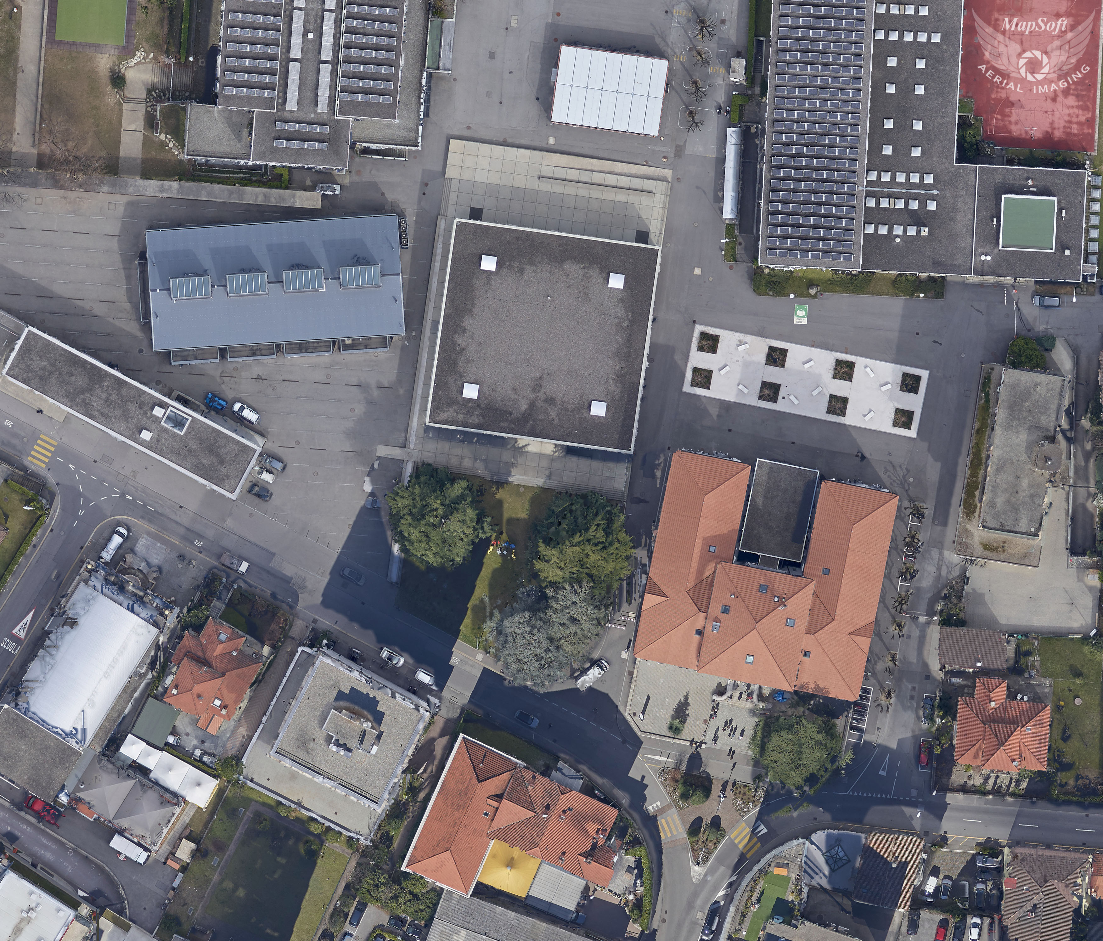
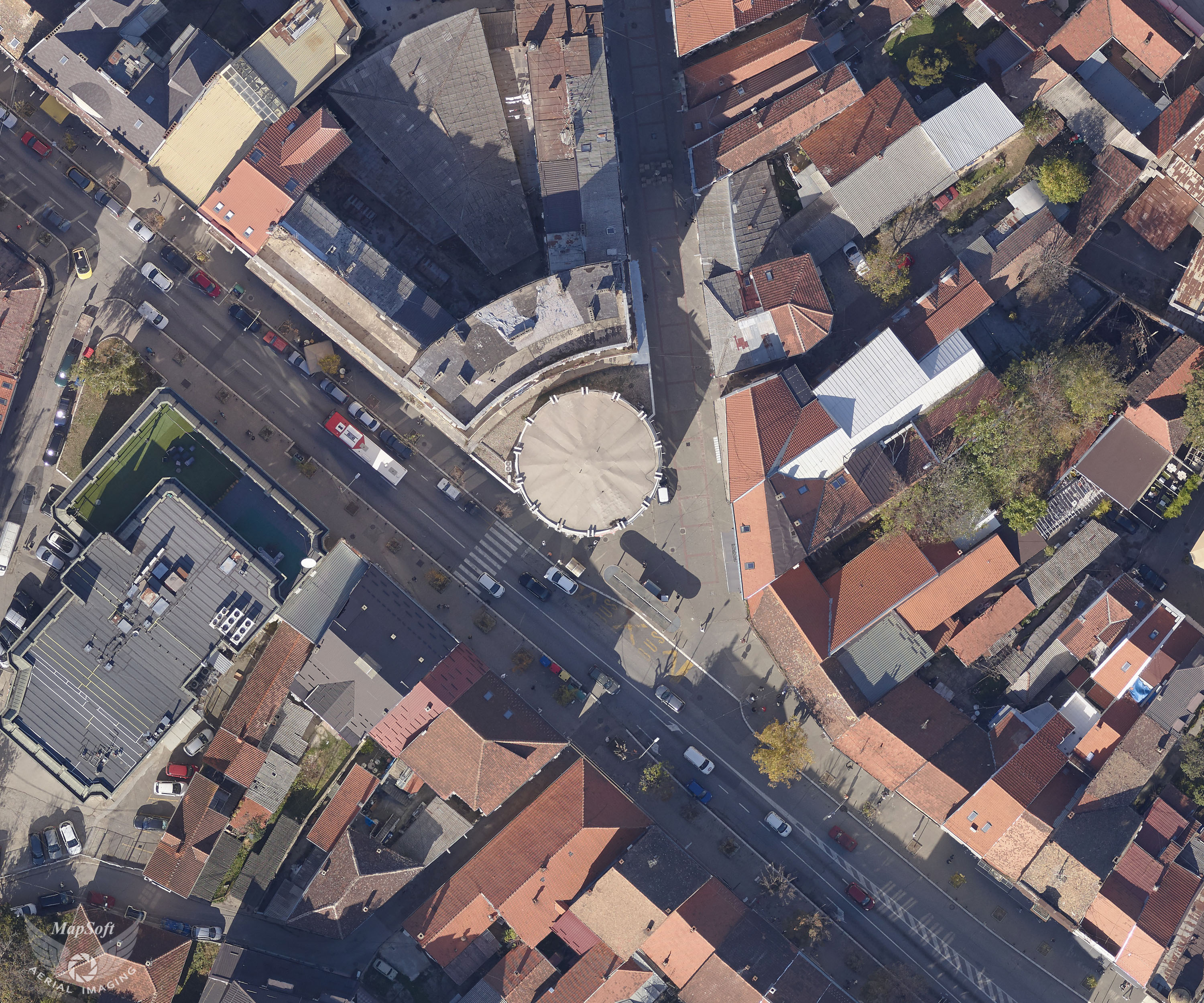
True orthophoto
Traditional orthophoto production uses digital terrain models (DTM) representing the topography of terrain without representing the detailed man-made features on the ground (like buildings, vegetations and bridges). These man-made features cannot be rectified correctly and the top and bottom of these objects are projected as two points still displaced from each other.
True orthophoto is an orthorectified image mosaic with geometric corrections properly applied to both bare Earth surfaces and aboveground objects (such as buildings, bridges etc.) in their exact planimetric locations.
MapSoft use simultaneous RGB+NIR imaging and laser scanning to get a high-quality DSM model in order to generate true orthophoto in the city areas.
Specification
- Georeferenced raster in tiles
- Standard raster file formats (GeoTIF, TIF+TFW, ECW, JPEG2000…)
- 4 bands (RGB+NIR) or 3 bands combination (RGB, CIR,…)
- Resolution 2 to 30 cm/pix
- Color matching between adjacent images
Applications
- Cadastre
- Base map for any kind of GIS applications
- Base map for cadaster (LPIS, tree cadaster, green areas and others)
- Spatial planning and urban planning
- Land use classification
- Cartography